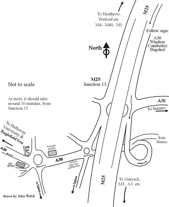
Motorway map & directions to Englefield Green
It's less than a couple of miles from Jcn 13 of the M25.
First, whilst on M25 follow signs for A30, Windsor & Camberley. At the end of slip road, at the massive R/B, follow signs for A30 but not towards Staines or London.
Go around the helter skelter type road and follow signs for the A30 and Royal Holloway Uni.
See the next map. It should take less than ten mins from motorway to the venue.
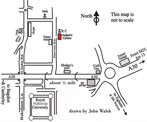
Map & directions to the Jurgens Centre
The Jurgens Centre is about a 100yds up on the right, a little past the Happy Man pub on your left.
There's plenty of parking. ________Back to Motorway Map